Pages

Monday 23 May 2011

Fuji Clear Up Weekend

Sarah and I decided to go up and help with the 'trash pick up' event that was planned instead of the UTMF.

It was a long way and we didn't get there until 10:00 pm, the hotel was great for a business hotel the rooms were big, the shower powerful and, with a bit of peering, Fuji was to be seen from the balcony.


We studied the route maps and elevation profile and decided that we would do the final section of the 3 suggested routes.

This began with a steep 3km climb, that just got steeper and steeper. There was no running this section at all. We climbed steadily getting occasional views of Fuji from between the trees.
Eventually we climbed out and joined the main trail traversing the ridge. We thought that we would have a fairly easy time of it from this point on. The scenery was brilliant, the trails outstanding (for the most part) and the weather glorious. There were however some challenges to be overcome.


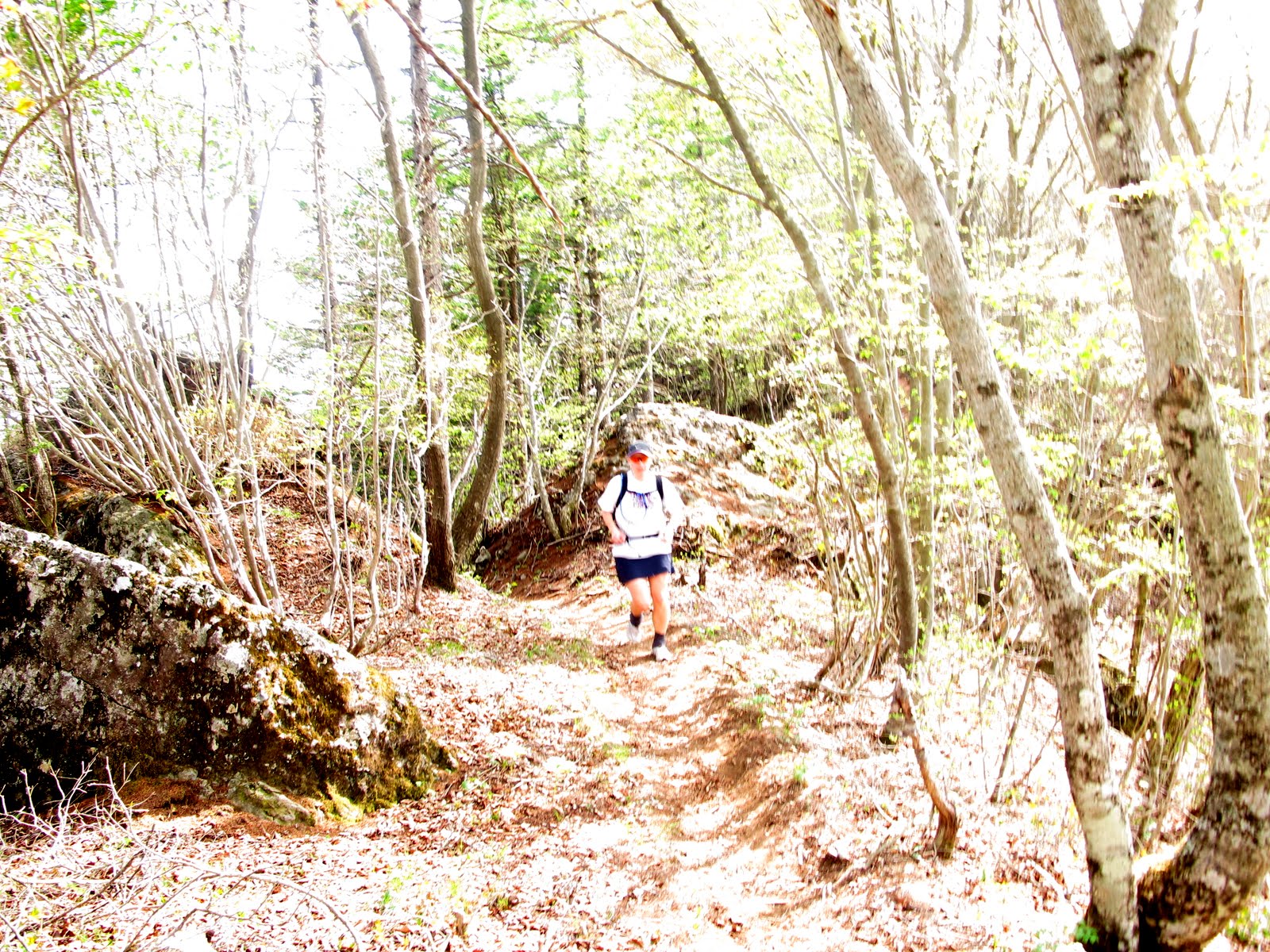
Steep and loose downhills were not infrequent in those first few km of the traverse. There were also very steep and loose climbs which caused a few problems and trembly knees. Then when we were sure it was all over and the traverse could begin in earnest we came to the ladder.
We climbed it, though not without a few moments hesitation. The exposure was really quite spectacular as it led to a two foot wide ridge trail of loose, pea sized gravel. Thankfully that was the last of the real 'hardships'.
Sarah was more than a little concerned during this section but she handled it superbly and shortly afterwards we caught a few other 'runners'.


The rest of the run went by with that usual mix of run, jog, eat, drink until we began to get a little concerned about water running out. It was then that Mr Kaburaki ran up to us, shook our hands, thanked us for coming and disappeared over the next small climb without seemingly breaking sweat.

The trail down towards Oishi Park was mostly tight steep switchbacks.


And there at the bottom were several of the North Face sponsored athletes and some others, like us, who'd just been out for a great day collecting trash in the mountains.
Tsuyoshi Kaburaki (center in white) and Yuki Tanaka (right in pink) 
Apparently over the 2 days and 5 or 6 stages that the runners were out, 40kg of trash was taken off the trails.


The reception in the evening was fun, there were toasts, speeches, beer and food. 5 of Japan's top runners were there doing a group chat which I'm sure was interesting but sadly incomprehensible. However I did find out that Yuki was not only an accomplished trail runner but she is one of the few women and the only Japanese woman to have ever completed the Paris Dakar race on a motorcycle.
I had a great time at the reception many people made the effort to talk to us and to make us feel welcome.

With a long train journey and some difficult connections to make we opted out of running and collecting trash on the Sunday instead we had a leisurely walk around the lake and made our way home. A great weekend, a beautiful place, outstanding scenery and some terrific people. What more can you ask for?

 Apart from an odd looking fellow in a parker sitting on a floating chair fishing, obviously.

Oh and a supersize stretch limo, who said Japanese cars are small?


Sunday 15 May 2011

The Ultra Trail Mount Rokko

Saturday 14th May 6:40 we all assembled outside Suma station on the Sanyo line to begin the first of the many climbs. Jacquelyn and Karin joined us to begin their hike and at 6:45 we set off on a journey that was going to bring highs and lows both mentally, physically and topographically and last for the next 11 hours.
Linda and Ken climbing the Suma Alps
The first few k went by in a bit of a blur as the pace ebbed and flowed, steps were cursed and climbed. Scenery gasped at, vending machines visited and Paul lost and found again.
Grumpy Boar
Arriving at the first 'bailout' option
The first drop out point arrived at 13k with our group a mere 15 minutes behind the estimated optimistic time. Bottles were refilled, camelbacks topped up and we set off towards the big hard staircase to the top of the next ridge. It was every bit as hard as I remember but this time, better fuelled, better rested and cooler I got to the top feeling much better than last week. We met up with Megumi K. and David at the top. We stopped, chatted, regrouped and moved on towards Futatabi. Shortly after that we lost Ken. We got to the picnic spot and headed off towards Mt. Maya, Ken on the other hand got there and headed towards Kobe. He would find his own way home from there, have a nap and a shower and get to the BBQ well ahead of us.

Mt Maya was another tough climb and when we got to the top we probably lingered a little too long. I phoned Sarah to let her know we were pretty much on schedule and would be at Rokko Garden Terrace for 2:00-2:30pm.
The tarmac sections then began to take their toll, pain was evident in the gait of several of the runners who were by now beginning to shuffle rather than run, and doubts were creeping in over the chances of us all finishing, especially as we were evidently in alligator country.

Me and Joe entering the Rokko Garden Terrace
We were met by Megumi T, and Peter Born who had ridden up all or part of the way. Peter Wilson, Katy and Sarah were also there having been driven up by Bob to join us for the run down, and Hiroki was there. It was the first time anyone had seen him since about kilometre 3 when he disappeared off the front.
The run down was fast and furious for some and utter torment for others. Joe was beginning to suffer quite dramatically but was not at any point going to give up, others were not having their best days or were just plain knackered having been on the go for around 8 and a half hours.

It was beautiful but technical. A trip, a fall, a suspected broken arm, a call for help, the walking wounded, all in the last few km of a brilliant day out. The tarmac for the remaining miles back to the island was hard and sore on the feet, the bridges became monster climbs and the green belt no longer looked or felt flat. I finished tired, happy, a little sore in the hips but other than that in remarkably good shape. We headed straight for the drink bucket and the food.
Joe refuels those beaten quads

 My day was done - the 'event(s)' seemed to go off well, at least I enjoyed my bit and all of a sudden I was incapable of any further action or meaningful thought. Bob kept me supplied with beer, friends came, stayed, then went, all of a sudden it was time to go and all the tidying up was done.

My thanks must go out to those that helped make the day a success (at least from my perspective) whether running, hiking, biking, fetching, carrying, cooking or hosting - THANK YOU.

The Garmin map and figures can be found at UTMR I still maintain the distances are under reading by 10-15%. Despite the Garmin distance being 48.25km or 30 miles there is no doubt we went a bit further than the 'Official Mount Rokko Longitudinal Route' which is 56km.

Well done to all.

Thanks also to Peter Stevenson and Bob Williams for the photos.

Saturday 7 May 2011

Suma to Shin Kobe


I'd planned to go to from Suma to Mt Maya but...

Turns out the trail doesn't start at Suma or at Sumakoen, it starts a bit west of Suma on the Sanyo line. Something we worked out thanks to the enthusiasm of two bin men and Linda's Japanese. So the 45 minutes to the start of the trail turned into nearly 2 hours.
The trail, when you find it starts as it means to go on with a step climb up some steps. It is lovely and there are some stunning views, great scenery and excellent trail but it is stop start.

The trail mixes very steep hiking with a little bit of running some 'yomping' through suburbia and probably the most sustained steep 4-5 km climb I've done in a long while, and we hit it at the hottest part of the day - not clever as there is no refuel point before Futatabi which left us both out of fluids.


Just after Futatabi we took a wrong turn and ended up retracing our steps, adding a few more feet to the elevation profile and probably another kilometre or 2 to the distance.
With all the delays the heat and my general fatigue we headed down to Shin Kobe from there and caught the bus back to the Island.


The signs in the suburban areas are there but sometimes take a bit of looking for they are usually white and usually (but not always) like this:


I guess the trail is no more than 30% runnable and probably about 30-40% paved in one way or another.

Having covered all of the Rokko Traverse now (exept the last few km to Takarazuka and I'm not planning on going that far) I would say the whole route is probably about 50% runnable (but probably not by me) and about 50% paved. There is a significant amount of hard hiking to be done.

Details Suma - Shin Kobe

Tuesday 3 May 2011

Not the best preparation 2

I don't learn, I should but I don't.
Race director of the Leadville series says 'you are better than you think you are you can do more than you think you can' or words to that effect. Not me.
Put me on a mountainbike and I can do anything, in my head. Apparently riding down a flight of steps is one of those ideas that should have stayed firmly locked inside my head.
12 stitches in total 4 in the forehead 8 in the ear.